

A fine view of central Prague with the famous bridge on the left hand side depciting the procession for Maria Theresia’s coronation., Image Size : 340×715 (mm), Paper Size : 360×735 (mm), Black & White, Copper Engraving Very Good, margins shaved closely.


1747, originálna kolorovaná rytina, rozmery listu: 41 x 53 cm, ‚A new and accurate map of the kingdom of Hungary and principality of Transilvania : with the bordering countries. Drawn from the best authorities, assisted by the most approved modern maps. The whole being regulated by astronomical observations / by Eman. Bowen.‘
Z diela Bowen, Emanuel: A Complete System of Geography: Being a Description of All Thecountries, Islands, Cities, Chief Towns, Harbours, Lakes, and Rivers, Mountains, Mines, &c. of the Known World. Shewing the Situation, Extent, and Boundaries of the Several Empires, Kingdoms, Republics, Principalities, Provinces, &c …, vydal William Innys, Londýn, 1747. Ilustrácia číslo 30.
Emanuel Bowen (1694? – 1767) bol britský rytec a obchodník s tiskovinami. Bol najznámejší pre svoje atlasy a krajské mapy. Aj keď zomrel v chudobe, bol za svoju odbornosť všeobecne uznávaný a bol menovaný za hlavného tvorcu máp pre George II. v Anglicku a Louisa XV. vo Francúzsku. Jeho podnikanie vykonával aj jeho syn Thomas Bowen. Vyučoval tiež mnoho učňov, z ktorých dvaja sa stali významnými tvorcami máp, Thomas Kitchin a Thomas Jeffreys.


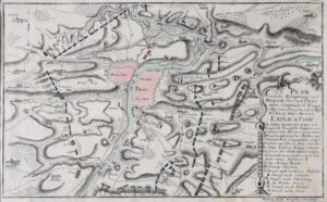
1757, částečně kolorovaná mědirytina, rozměr listu 25 x 39 cm, znázorňuje obléhání Prahy pruským vojskem od 6. května do 20. června 1757, které následovalo po porážce rakouské armády v bitvě u Štěrbohol v rámci Sedmileté války. Je označováno za nejničivější obléhání v pražských dějinách.


1762, rozmery listu: 39 x 55 cm, ‚Le royaume de Hongrie divise en haute et basse Hongrie Transilvanie Bordeaux Esclavonie et Croatie…‘
Z diela BONNE & RIGOBERT: Atlas moderne ou collection de cartes sur toutes les parties du globe terrestre par plusieurs auteurs, vydal Lattré Graveur & Jean Thomas Herissant, Paris 1762.
Významný atlas zostavený najlepšími kartografmi 18. storočia, ktorý poskytuje presný prehľad o svete okolo roku 1760.
Máte dotaz k naší nabídce uměleckých děl? Vyplňte a odešlete formulář níže, ozveme se do 24 hodin.
Do you have any questions about our artwork collection? Fill out and submit the form below, we'll get in touch within 24 hours.


Sign up for our newsletter Periodically you will receive to your mailbox concise summaries about investment opportunities in the arts.
© 2017 Invest In Art
